The Trails
Guide
Maps
Miles/Ele
Permits
Resupply
Forum
Current Weather Conditions
Weather Notes
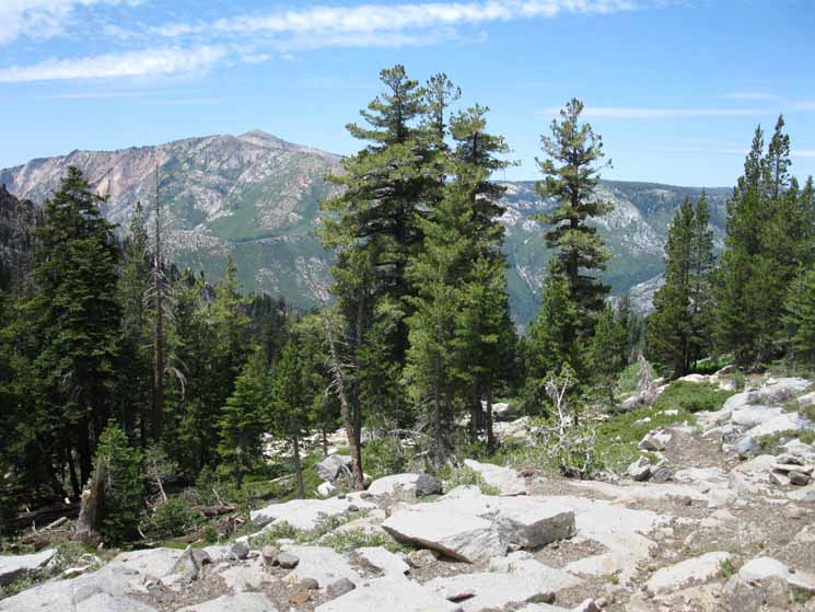
Northern High Sierras
Central High Sierras
Southern High Sierras
Gear
Gear List
Gettin Started
Layering
Discussion
Testing yourself and your gear
Gear Reviews
Backpacking
Up the North Flank of Mount Reba
CAMP IRENE
to the
Top
of
Mount Reba
Hiking the Tahoe to Yosemite Trail out the South End of the Mokelumne Wilderness
Languages
Languages
Trail Arts
The art of walking
Physical Preperation
Trail Skills
The trail
Off the trail
Scrambling
Maps
Navigation
Camp skills
Food
Resupply
Food
Other
Photo Catagories
Trail Stories
Trail Culture
News and Science
Links
Groups
Books
Terms and Conditions of Use
| Trail Guide INDEX Carson Gap to Lake Alpine |
TYT North Camp Irene |
TYT South Lake Alpine |
Topo Map Summit City Ford to Mount Reba |
Big Map Summit City Creek to Reba |
Section Map Echo Summit to Lake Alpine |
Map Index Carson Gap to Lake Alpine |
Carson Gap to Lake Alpine MILES AND ELEVATIONS |
EL Dorado National Forest |
Stanislaus National Forest | Tahoe to Whitney on You Tube |
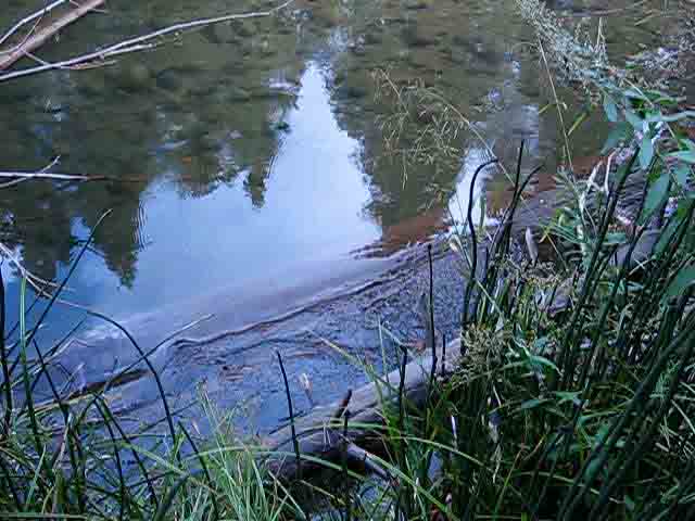
North and South
across the
North Mokelumne River
at
Serene
Camp Irene
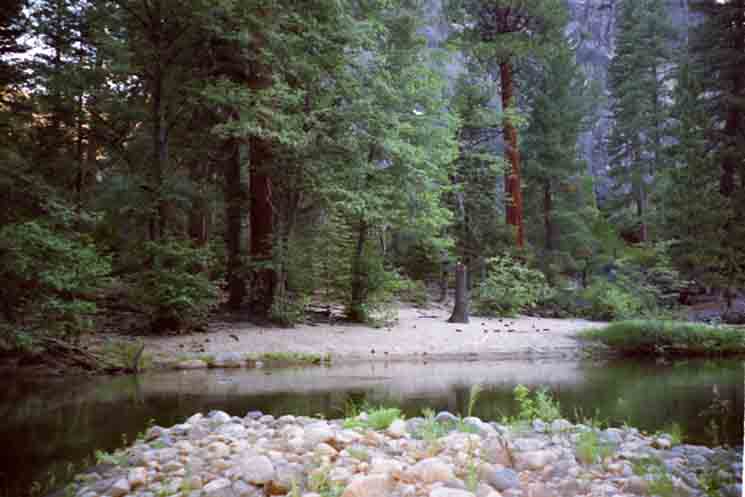
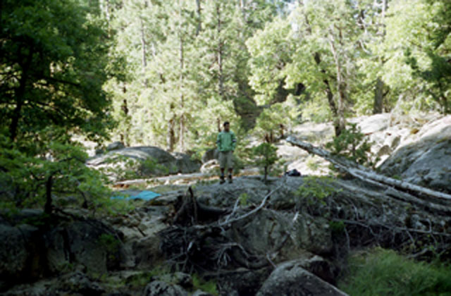
Looking South along the Tahoe to Yosemite Trail route
Across the North Mokelumne River at Camp Irene
 |
||
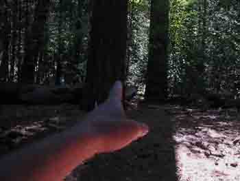
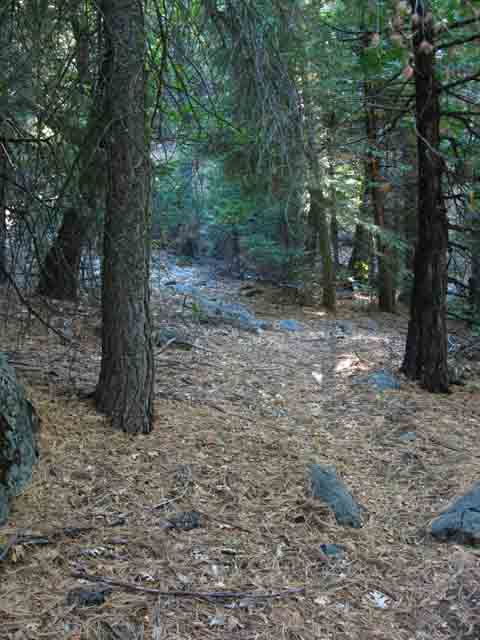
Approaching the river hiking South down the Tahoe to Yosemite Trail our best fording position is downriver, to our Right, or South. We are looking to our West by the compass. After crossing the North Mokelumne we've got to find and follow a very faint route downriver to the point where our route turns Southeast to begin the fierce climb over beautifully complex terrain up to the top of Mount Reba. But not to worry too much, because as we turn away from the North Mokelumne River for the climb out of this massive canyon the quality of the trail route improves considerably. Though faint in places, crossed by fallen trees in others, and sometimes completely overgrown with dense manzanita there is continious trailbed, and reasonable duckage providing a followable route from bottom to top. We may have to stop and look around every now and then to find it, but it is there and find it we will.
|
View Looking West
View of the Pristine Camp area on the North Bank across the rocky South Shore of the North Mokelumne River
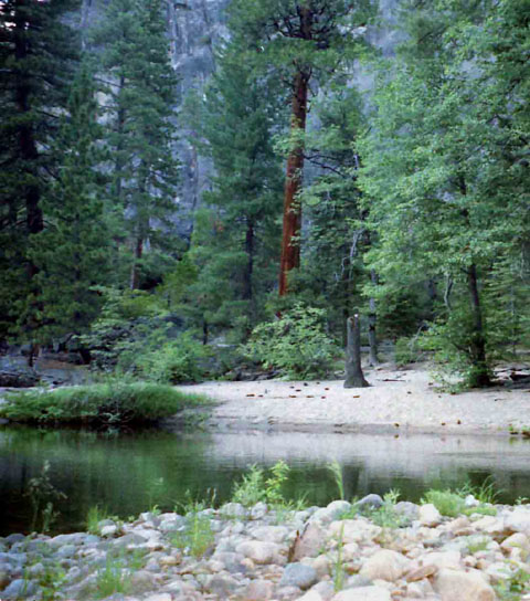
North Mokelumne River Ford at Camp Irene
 |
Camp Irene Ford during high Spring Thaw flow. End of May 2014. Peter sent us this great shot of the North Fork of the Mokelumne during high Spring Thaw flow levels. Peter's perspective is looking Southwest across the North Mokelumne at the point on the North shore where he began his ford. Peter posted up a trip reports on Peter's and Peter also provided Tahoe to Whitney with an excellent account of his early season hike on the These accounts are good information for all prospective as well as experienced Tahoe to Yosemite Trail hikers. |
Video
Fording Camp Irene hiking South to rise above the Forest Cover
Hiking 1.98 miles South of Camp Irene This video explores the campsites on both shores of the Camp Irene ford, mostly focusing on finding and visiting the two excellent campsites on the South Side of the ford. The last video of this Southbound hike down the TYT explored the fine campsite on the North shore of the Camp Irene ford. After checking out the Camp Irene campsite above the South shore of the ford, and the site downriver from the ford, we search out the faint trail remnants and ducks leading us South from Camp Irene on our 5.25 mile climb up 3340 feet to the top of Mount Reba. This is a difficult hike. The video above covers the first 1.98 miles hiking South from the ford up 720 feet to the point where we climb above the forest cover, giving us grand views of the surrounding terrain as well as putting ourselves under the sheer face of the ridge composing the Northwest end of Underwood Canyon.
|
Backpacking Information
|
|||||||||||||||||||||||||||
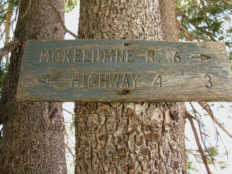
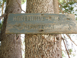
The Mileage Post at Camp Irene posts the mileage to Lake Alpine at 8.8 miles. As you can see, I have the distance at 8.02 miles. The best time to make the long, hot, exposed 5.24 mile hike up to the top of Mount Reba from Camp Irene is in the chill of early morning. |
| Warning Backpacking is Dangerous |
|
On this page |
||||||||||||||||||
South and North across the North Mokelumne River
VIDEO
MILES AND ELEVATIONS
South Bank Camp Irene Campsite
Southeast into the rising Forest
Peak guarding Northwest end of Underwood Valley
Climbing South out of the Forest
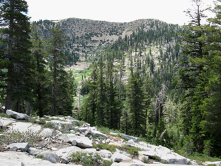
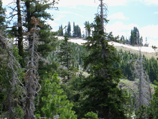
Low and High Views of Summit City Canyon
VIDEO
Out of Forest and onto the Rock
Peak Guarding Northwest end of Underwood Valley
Peak Guarding Southwest end of Underwood Valley
|
Weather Trailheads to the North are located along Highway 88 where our Tahoe to Yosemite route and its variations cross Carson Pass. Trailheads to the South are along Highway 4, which we will cross at the East Shore of Lake Alpine. Direct links to Highway 88 and 4 reporting stations and road conditions are located below. Below also find the closest Ground Stations, Point and Regional Forecasts near Our isolated position along the North fork of the Mokelumne River between Highways 88 and 4. Note that the ground reporting stations that are at the same elevation and aspect of sections along our route may be somewhat representative of the conditions we will experience. The latest Satellite and Radar Imagery linked to below provides almost real-time Long Range and Regional overviews from an almost God's Eye perspective.
All Weather All Comprehensive Though focused on High Sierra Weather between Lake Tahoe and Mount Whitney, all the weather resources above can be adjusted to cover your favorite backpacking area or your home. |
Down the North Mokelumne River Canyon
Peak on end of Ridge dividing Underwood from Lake Valleys
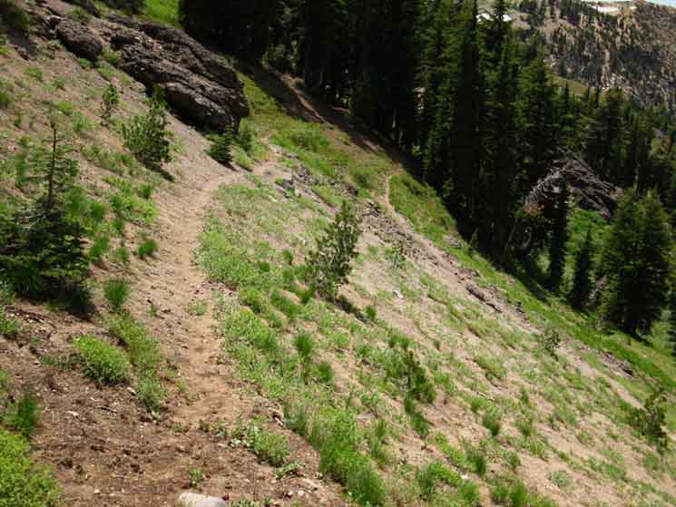
Manzanita traverse into Lake Valley
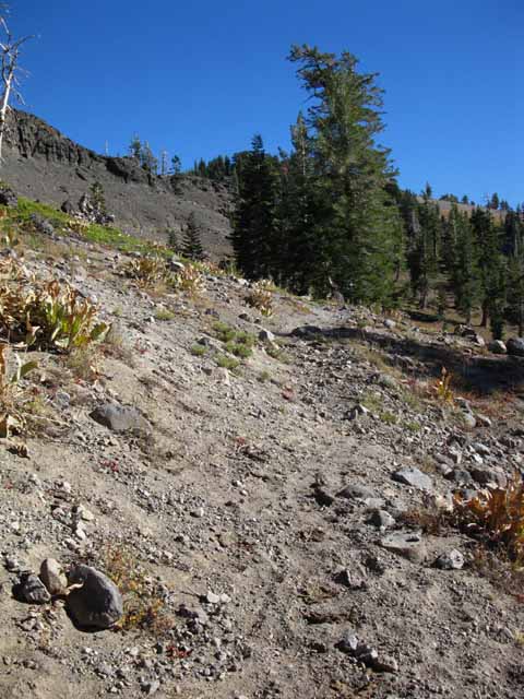
Approaching interface between granite and volcanic terrain
Upper Lake Valley
Lake Valley and Surrounding Terrain at our Feet
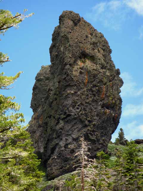
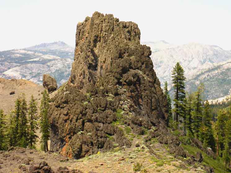
Gallery of Volcanic Sculptures
Switchbacks to the Top of Mount Reba
Last Switchback to the top of Mount Reba
Down the South Side of Mount Reba
Road Map |
||||||||||||||||
| >Forum< | ||||||||||||||||||
POST UP!
All backpackers can post text comments about the following section of trail through the comments links on all the trail guide pages. Registered Members can post up stand alone post about the trail with text, images, maps and videos in the Trails Forum that supplements this section of the Trail Guide.
Hiked this section of the Tahoe to Yosemite Trail lately?
Post up a
Scouting Report
Check out the Tahoe to Whitney .org Backpacking Trails and Topics forums
Looking at the North Shore across the North Mokelumne River
 |
Notice here, again, the perspective we have on the broken off snag from this South bank perspective. Note the great granite structure rising, and dominating the Right-background (Northwest) of the image. We can see the warm glow of sunset on the upper-Left background of the image. Our Northbound fording Spot from this position looking Northwest is off to our Left. |
Fording the North Fork of the Mokelumne River
at
Camp Irene
Let's go Check Out the Ford Point
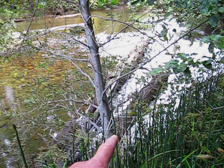 |
The most shallow ford position is on the South side of the pooling position of the North Mokelumne River when we are hiking North or South on the Tahoe to Yosemite Trail. This configuration will be swept away by the first significant Spring Thaw. But that may happen next year, or in ten years time. My point is that the configuration that will preserver is the pool. If and when the logs float away, which they eventually will, then the Camp Irene Ford will revert to its most basic configuration: a very wet waist to armpit easy wade (depending on season) across the placid pool over to the other side. I prefer the complexity of lowering myself down onto the foot-wetting trunk of the longest of the fording trees, and a "tree-tightrope" downstream to the shallow gravel bank that's collected on the downstream side of the fantistic pool that marks the riverside location of Camp Irene. Otherwise I would have to wade waist-deep across here, which I would prefer not to do unless I have to. I'll push across very rough conditions if I have to. Otherwise I find the easiest and longest route possible... |
Drop down onto the end of the semi-submerged trunk
 |
Camp Irene Ford.
|
Walk out into the Shallows
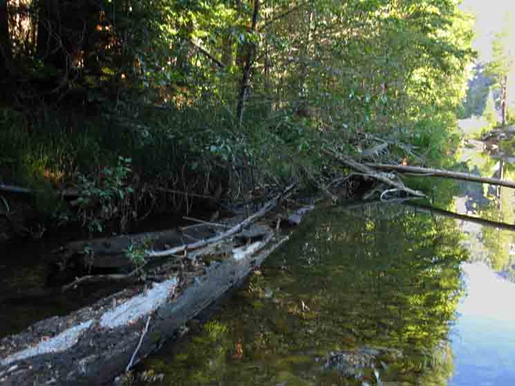 |
Looking back, upriver and North while fording the North Mokelumne River at Camp Irene on the Tahoe to Yosemite Trail. |
Upstream View of Camp Irene Ford from the South Bank of the North Mokelumne River
 |
Camp Irene Ford point on the North Mokelumne River. We've made our Southbound ford and are hiking downriver along a faint path. |
Lets find the South Shore Campsite
Hiking Further Downstream we look back again at the Fording Point
 |
||
We have hiked about a hundred yards downriver after crossing the ford to the South side of Camp Irene. I'm pointing upriver at the fording point we just crossed over. Note the brightly lit up tree in the upper Left corner of the above image. That is the tree in the Right foreground of the second picture above. The ford is just a few feet upriver from this tree. I'm pointing at the fallen tree above the ford point from the position where we can turn East, away from the river for an easy hike up to the main South shore Camp Irene campsite. Before this point we can hike up to the campsite, but the jumbled terrain makes it more challenging to both walk around and find the campsite. We can hike directly to the campsite from the ford, but the jumbled terrain makes it a lot easier for us to hike a hundred yards South along the riverbank to the two fallen trees pictured below before turning up and away from the river to the main Camp Irene campsite.
|
Two Fallen Trees
To the South Shore Camp Irene Campsite
 |
 |
|
From the position about a hundered yards downstream where we pointed out the ford above we see these two fallen trees just a few feet to our East. |
I am pointing out the way to the South Camp Irene Campsite around the Right edge of the tree. |
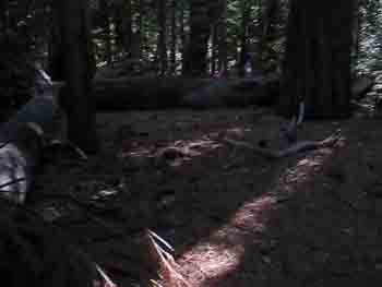
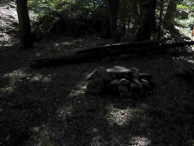
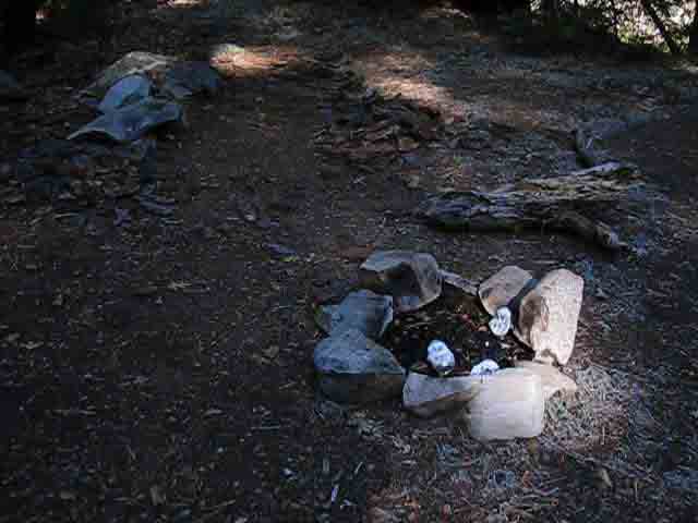
Camp Irene
South Bank Campsite
 |
||
Fire ring, benches, nice flats for sleeping. A Sweet Spot... OK, back to the two downed trees and the Southbound Tahoe to Yosemite Trail out of Camp Irene.
|
Trail Conditions
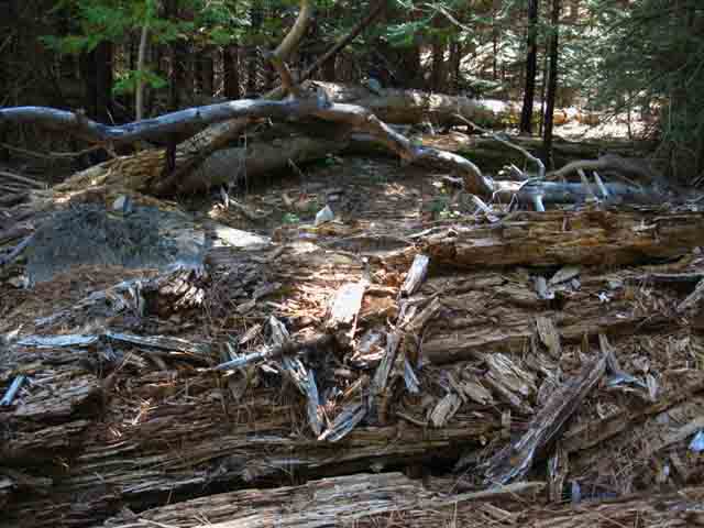 |
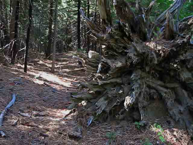
The trail conditions around Camp Irene are rough, as indicated by the obstacles we have to cross. |
 |
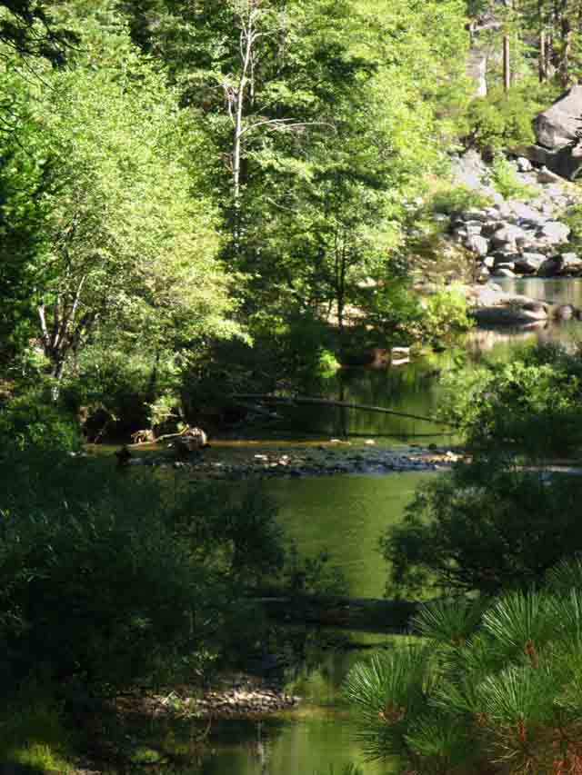
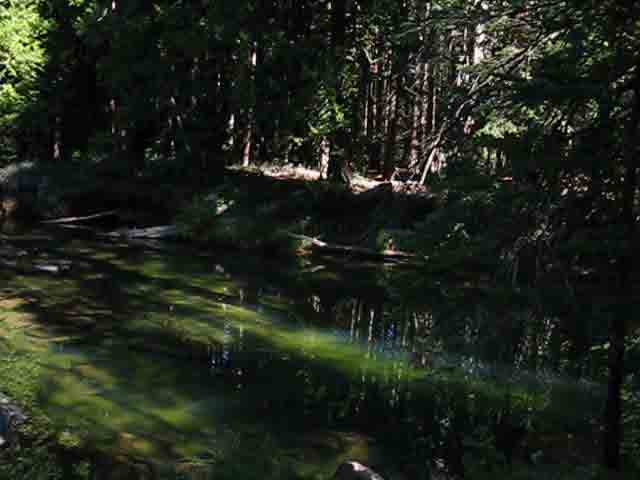
Duck marking fine campsite North of Camp Irene. After circling through/around the rough section of fallen forest our route swings back to the riverside, better quality faint trail, and this duck marking the path towards a fine campsite nestled on a flat above a pooling section of the North Molkelumne below the ford at Camp Irene. A thicket separates our trail from the campsite. Follow this trail through the thicket to the river to find an excellent campsite. |
Campsite and Pool South of Camp Irene
 |
Campsite South of Camp Irene. I am getting real tired of seeing non-burnable crap in the fire rings. I like beer. I never carry beer, but if I come upon beer in the wilderness I carry my empties out. So should you. But it's much smarter to carry a plastic flask... and I don't even do that. But I will buy you one in the Lake Alpine Bar, the Kennedy Meadows Bar, and buy you a beer at the Tuolumne Meadows Store. |
 |
||
Pool along campsite South of Camp Irene.
|
Evan and the Bear I met a cool dude, Evan, from Marin County, at the campsite located South of the Camp Irene fording point. This must have been around 2000. He was cruising around looking to safely store his food away from a bear prowling the area. |
||
 |
||
This was Evan's first backpacking trip. He picked a good trip for his capabilities, making a solo three day round trip from Lake Alpine to Camp Irene and back. This is a hard trip for a first-timer because it is in a remote location, the trails are good if thin, and it is a hell of an Eight Mile Climb from Camp Irene over the top of Mount Reba and down to Lake Alpine. Evan gave himself a good challenge for his first backpacking trip. Here's my notes on this encounter, it was 1999: "Sunday, Sept 5, 1999. Walking back to his camp Bear, was approaching his camp & (bear) departed very quickly upon our arrival. I showed Evan the proper way to suspend food." When I ran into Evan he was worried about the bear that was actively trying to get his food. Neither was used to each other. The bear was not used to humans, and was fearful but hungry. A Yosemite Valley bear would have just walked right into Evan's camp, taken the food, flipped him off, and sat down and ate it right in front of him. Trust me, I know! But that is yet another bear story. But this particular bear was not acclimated to humans, and was very uneasy approaching Evan. Evan, on the other hand, was doing his first backpacking trip and was as unused to bears, or protecting his food from a bear, as the bear was unused to him. Evan was very uneasy having the bear approaching his camp and probing his defenses. This made for a situation where two very nervous creatures were eyeing each other uneasily across a void of mutual uncertainty. One wanted to steal food, the other wanted to prevent that. Neither had a great deal of experience with the other. I met Evan as he was checking out moving to a different campsite closer to Camp Irene proper from his camp just a bit further South of Camp Irene, along the SE shore of the North Mokelumne River. He explained his bear problem, and we went back to his camp site and I showed him how to scare the shit out of the semi-wild bear prowling his camp. I make bears that are curious about humans never want to see a human again. No bears are injured during these lessons, though their feelings of comfort around humans are destroyed. Better me putting a deep fear of humans into the bear before a hunter or ranger shoots the poor bastards after they become acclimated to humans. (If any of the Riverside Firemen I met mule-camping at the camp in Fish Valley read this, POST UP! That was a great time, & yet another great bear story...That bear didn't bug you guys again after I got done, did it?) Then I explained "Bear Technology" to Evan and showed him the two basic ways to hang food, the counterweight and hidden line methods on a tree branch that was bear-proof. I'll put up articles about the stuff I mention above, being Bear Tech, scaring the shit out of "borderline" acclimated bears, and proper food hanging in the Bear Section of the Living Things Forum as I continue building this trail guide South towards Mount Whitney. Evan, if you see this Post Up! |
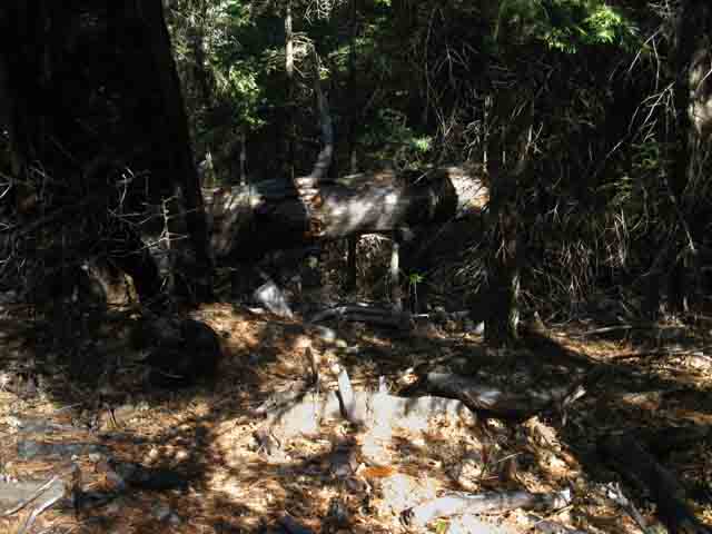 |
Fallen snag blocks Tahoe to Yosemite Trail. |
 |
||
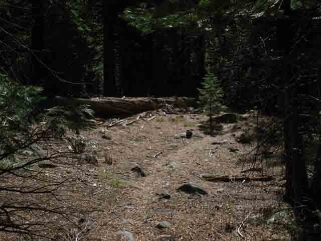
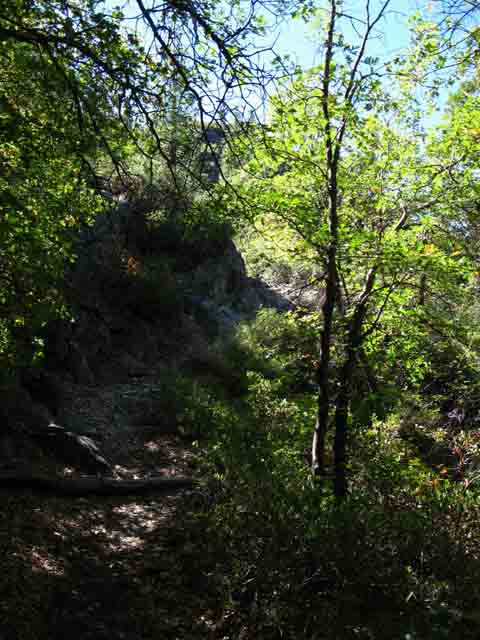
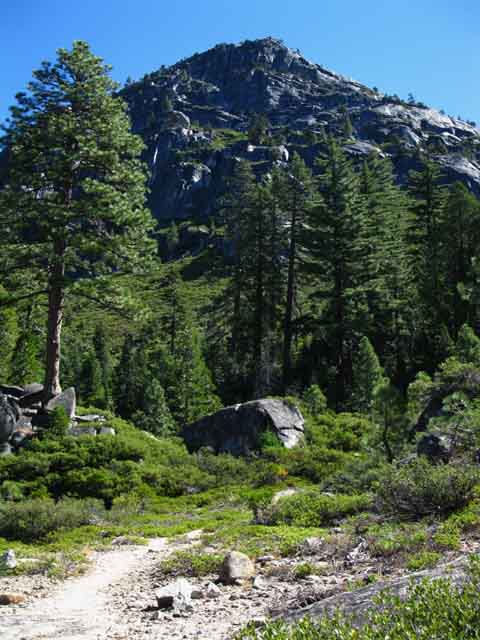
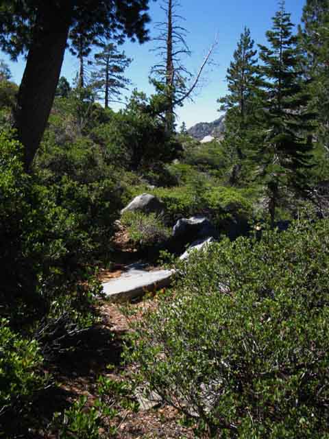
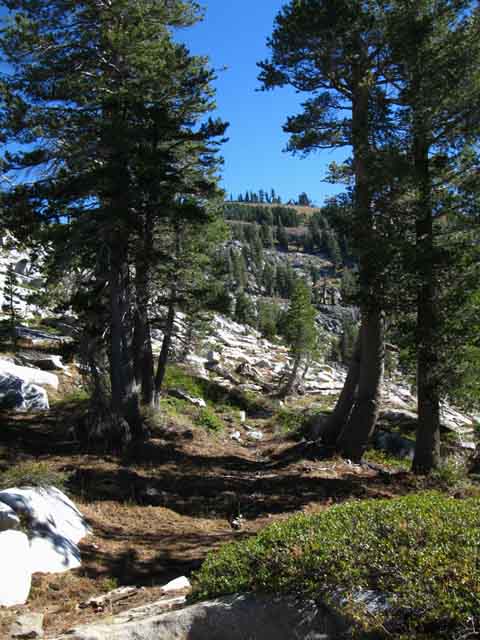
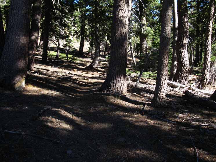
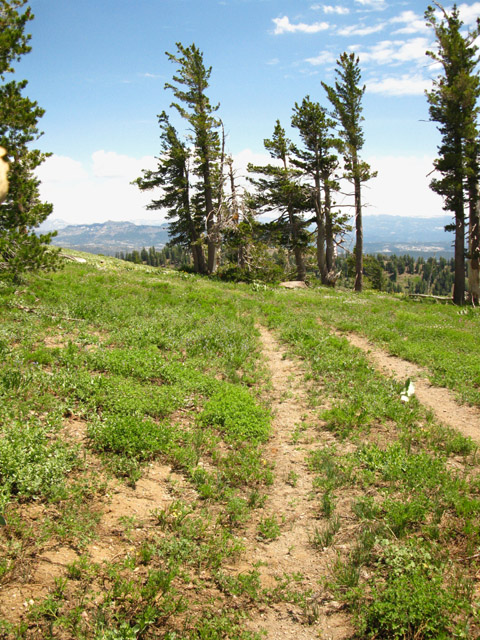
Good trailbed characterizes the Tahoe to Yosemite Trail South of Camp Irene.
|
 |
Peak guarding Northwest End of Underwood Valley. |
 |
Still a trailbed. |
 |
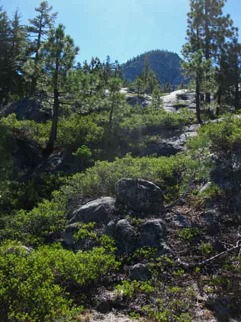
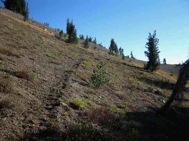
Forested Switchbacks moving us quickly out and above the forest. |
 |
Climbing above the forest. |
 |
||
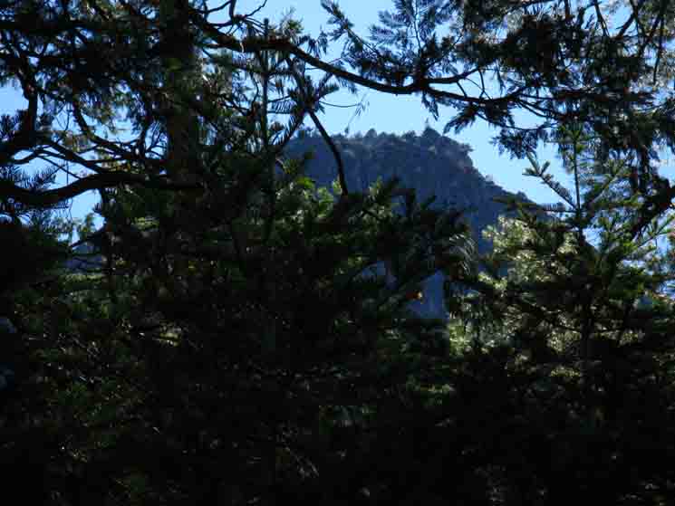
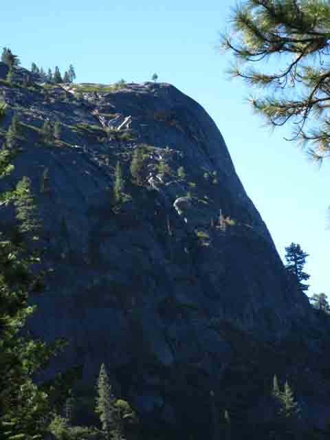
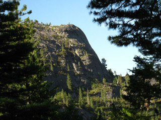
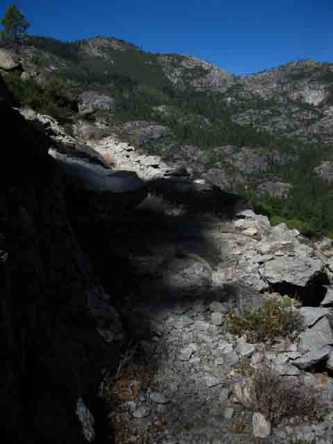
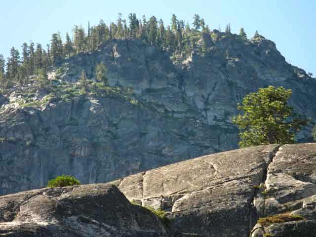
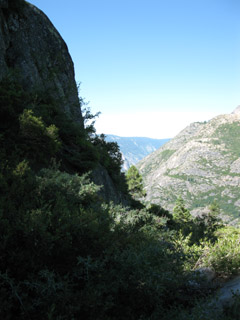
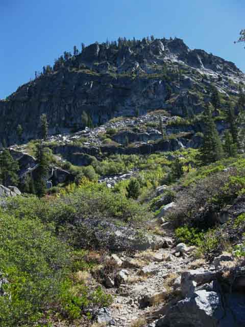
Granite cliff marks our route South. Our trail South passes above and to the Left, the East of this formidable feature.
|
 |
v |
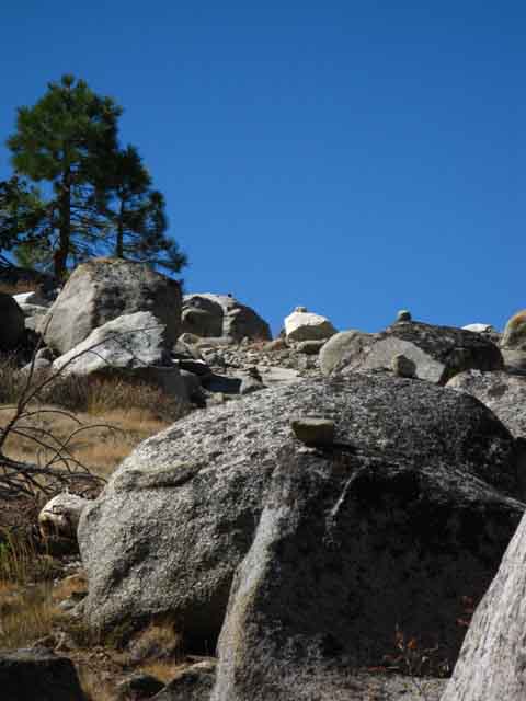
Massive rock formation on the Northwest side of the Camp Irene Ford
| We are climbing up, South out of Camp Irene. This picture is looking to the North. The great rock dome pictured here is the main feature that sits between Camp Irene and the Enchanted Forest that we came through on the North side of this huge rock. | This is the flat below the dome, pictured at Left. Check out the map, and notice how the N Mokelumne River bends around the base of this feature, passing though a very steep and narrow gorge at its base, before spreading out at Camp Irene. |
|||||
 |
 |
|||||
Our trail from the Enchanted Forest passed around the West side, the Left side of this rock. The East side, where the N Mokelumne River passes through, is impassable for hikers. Note the flat at the bottom Right of the dome. The next picture shows the flat. |
When you are climbing South out of Camp Irene, make sure you check the view North, to understand the features that determine your trail's route. |
 |
||
Emerging from Forest above Camp Irene.
|
Grand Views North
 |
v |
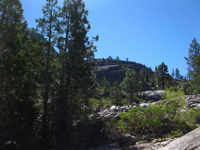
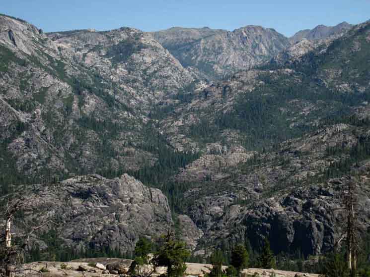
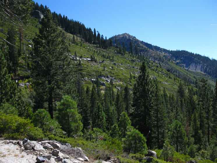
| Higher up on the Northwest flank of Peak 8353 hiking South high above Camp Irene. This is the view looking North. The canyon running from bottom Left to top Right is Summit City Creek. Horse Canyon is cutting deeply into the Northwest flank of Summit City Creek's canyon. | ||
 |
||
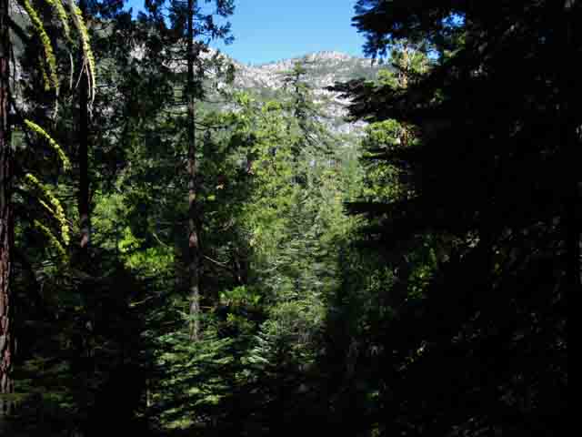
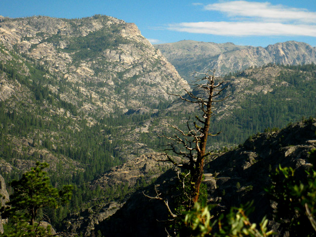
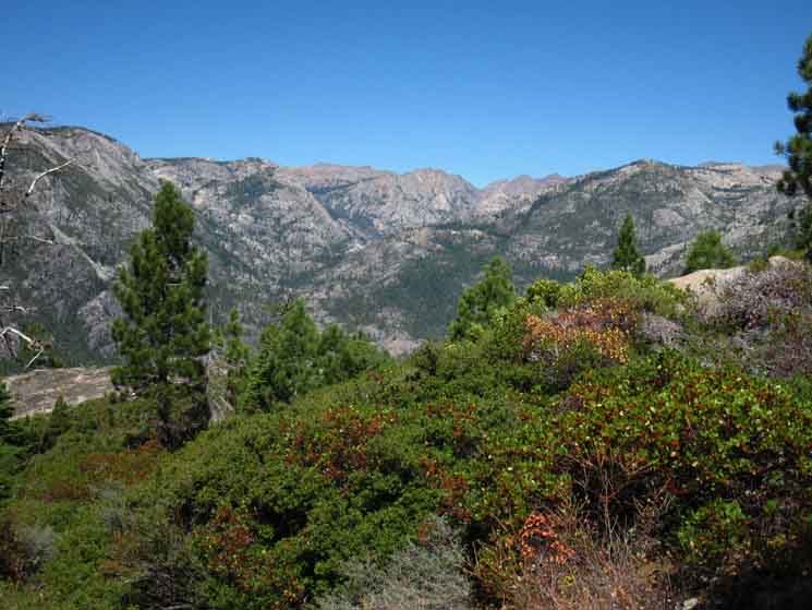
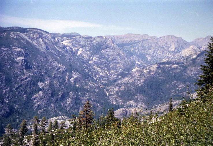
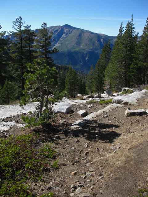
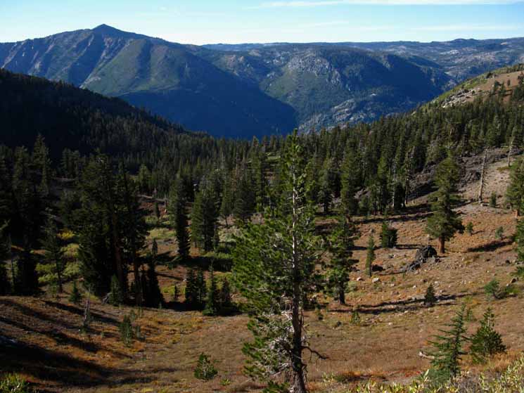
Summit City Creek is about 800 feet below where the hanging base of Horse Canyon cuts through Summit City Creek's canyon wall. The highest point on the ridgeline North of Horse Canyon, along Summit City Creek, is peak 9607. Identify it on the Carson Pass Region Map. Covered Wagon and Melissa Cory Peaks sit on the crestline in the far distance behind and Left of peak 9607.
|
VIDEO
Above the Forest to the Top of Mount Reba and on down to Lake Alpine
The previous video brings us climbing 1.98 miles up 720 feet of elevation South through and above the forest behind Camp Irene. The video starts with a hike 3.26 miles from our position above the forest surrounding Camp Irene up another 2720 feet of elevation while passing under the mouth of Underwood Canyon on our way to enter Lake Valley for the final length of our hike to the Top of Mount Reba. The total of our hike from Camp Irene to the top of Mount Reba crosses 5.24 miles of trail climbing 3440 feet of elevation. The end of the film covers our 2.78 mile hike down 1400 feet of elevation from the top of Mount Reba to either the Bee Gulch Trailhead on the East shore of Lake Alpine or the backway into the Lake Alpine Lodge. This film, when combined with the previous film, covers the 8.02 miles between Camp Irene and the Bee Gulch Trailhead on Highway 4 at the East Shore of Lake Alpine.
|
 |
v |
 |
||
End of Northwest Ridge above Underwood Valley. Our route is carring us to the Right, to the South of this first peak we will pass under on our climb up to the mouth of Lake Valley.
|
 |
A little higher up our route bends Southeast and we can make out the End of the Southwest Ridge dividing Underwood Valley from Lake Valley on the other side. This is the next peak we will cross under and bend around its Southwest flank to enter Lake Valley... Looking North at our position from the End of Summit City Canyon. |
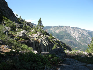
Terrain
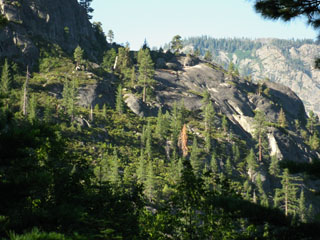
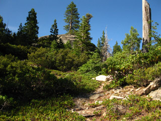
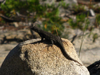
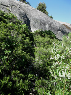
| The varied terrain of trees, brush, and rock. Note the faint trail before us. | This is Lizard Territory. | |||||
 |
 |
|||||
| The trees are not dense enough to give cover from the Sun. The brush had overgrown big sections of trail as of July '09, but the trail was still visible and followable to the next open section. | A large population of lizards lives on the Northwest flank of Mount Reba. I believe the hot, exposed nature of this area is good for them. |
 |
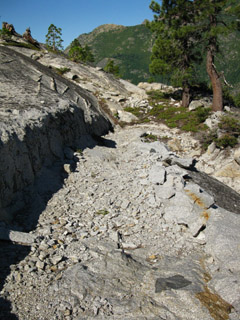
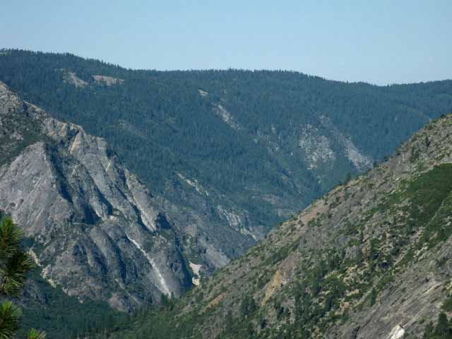
Freshly chipped trail. Across the canyon on the other side of the North Mokelumne River we can see the flank of Mokelumne Peak, and barely make out the tips of the Mokelumne Tetons along its flank. |
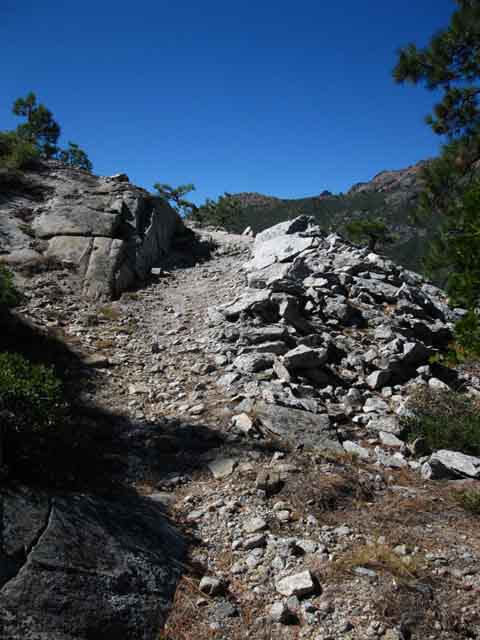
| Recent rock work. This trail previously had chipped-out sections along the granite marking the trail route, before this massive amount of work. You can't miss the trail now! | ||
 |
||
This section precedes a right turn in the trail, where your climb will parallel the fall of the creek draining Underwood Valley. |
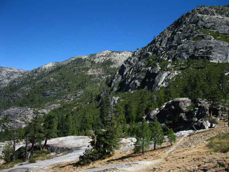
Great Rock Wall to the sw of Underwood Valley
| Heading up to the Rock Wall guarding the Southwest End of Underwood Valley. | ||
 |
||
There is a nice flat at the base of this rock wall with expansive views up and down the North Mokelumne River and up Summit City Creek. This would make a wonderful place to camp, but there is no water nearby. We will pass from Left to Right under this impressive wall. I took this shot while still some distance below this upper part of the trail. When we get there we will bend Southeast, to our Southbound left, to hike around to the Right side, the Southwestern end of this wall to cross its manzanita-covered flank to enter the mouth of Lake Valley. Looking North at our position from the End of Summit City Canyon.
|
 |
We are now hiking up, over and around the great granite features we observed from the end of Summit City Canyon. Pretty cool terrain here, back there, and in-between. Underwood Valley is above us to the East, our Left. We can see the peak at the end of the ridge dividing Underwood Valley from Lake Valley in the upper Left corner of the image. We're going to bend around the far flank of that peak entering Lake Valley. What a frkn amazing hike... |
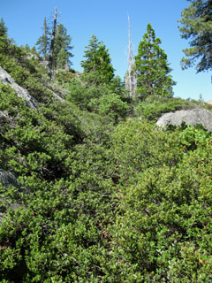
| Yes, this is the trail. | This thicket is also part of the trail. | |||||
 |
 |
|||||
Though the trail through here is maintained and easily passable, there are some sections of manzanita that are almost totally grown in. |
Sections like this one are the reason why your pack should be properly secured, and of a strong fabric. |
Hot Pines
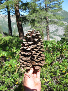
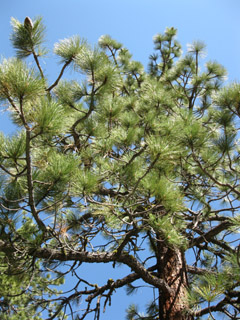
| Jeffery Pine Cone. | Jeffery Pine. | |||||
 |
 |
|||||
Jeffery Pines like warmer locations. |
The Rock Flat preceding Underwood Valley
| The nice flat under the rock wall guarding the Southbound entrance to Underwood Valley.. | A granite boulder split into almost symmetrical shards. | |||||
 |
 |
|||||
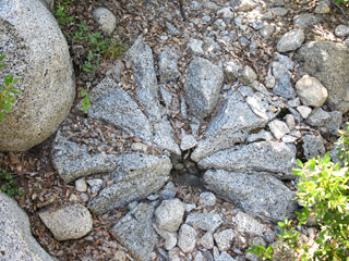
| This would be a fine place to camp if there was any water nearby. | This looks like trail crew rock art. |
| Heading South around the edge of the rock wall will bring us climbing up, to pass below the mouth of Underwood Valley. Passing by Underwood valley bring us under and around the nose on the ridge under the peak of Mount Reba to Lake Valley. | As we head South, views of the North Mokelumne's grand drainage canyon, which is making a big turn West here, opens up. | |||
 |
 |
|||
| We can now see down the massive North Mokelumne River canyon. Soon, we will be at the top of Mount Reba, and our views will again encompass most of the horizon. | ||||
| As we turn the corner we will lose our majestic view of the granite vault holding Summit City Creek. | INDEX |
 |
||
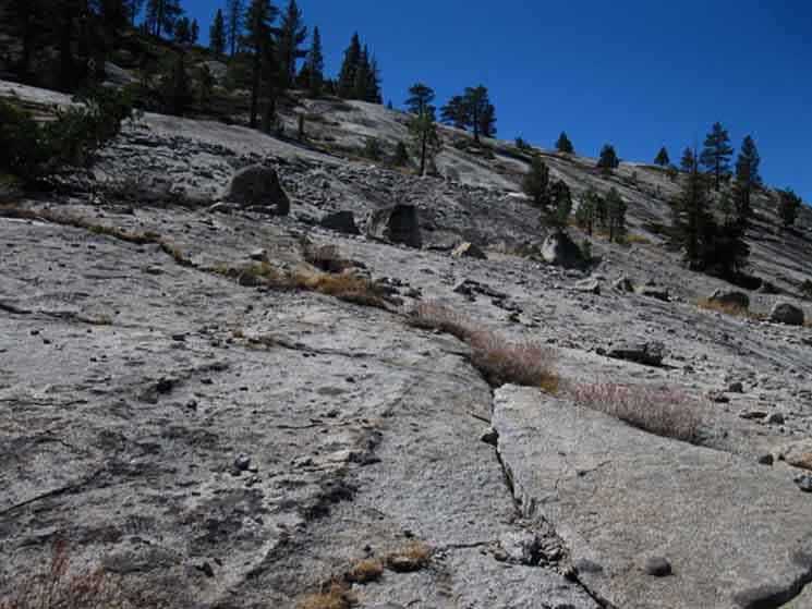
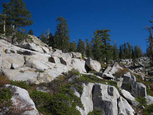
Expanses of bare granite weathering over eons.
|
 |
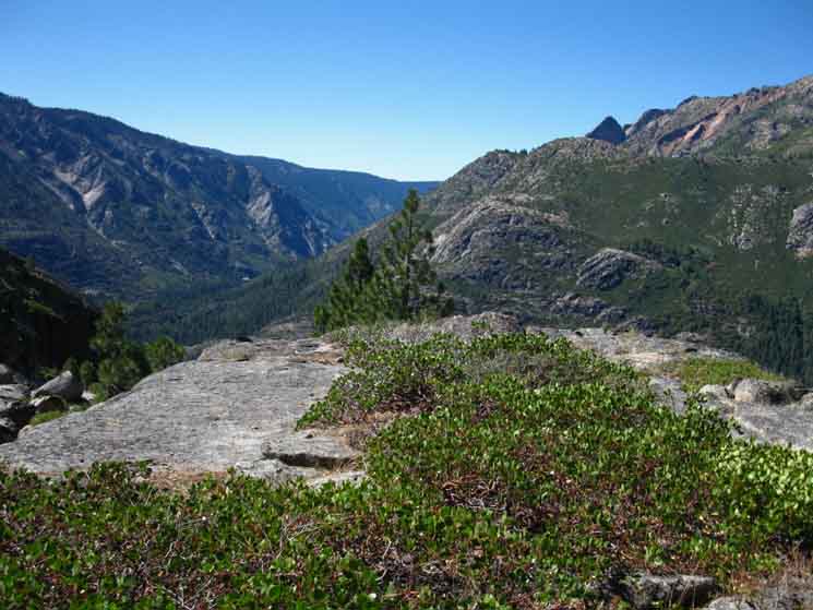
View Northeast across Underwood Canyon's Northwest end. We've just climbed South up to, then across the bottom of this beautiful rock. On the far side of this rock a creek runs from Camp Irene up to Frog Lake. The North fork of the Mokelumne River runs from the far side of the Underwood Canyon rises to our Right on this side of that peak, that massive pile of rock marking its end. |
 |
Line of trail ducks leads us up the mountain. |
 |
||
v Looking North at our position from the End of Summit City Canyon.
|
The Canyon of the North Fork of the Mokelumne River turning West
 |
8133 |
| Long view Southwest down the North Fork of the Mokelumne's river basin. | ||
 |
||
Rough Country. There's stories of lost cabins down that valley... |
View Down the Canyon of the North Fork of the Mokelumne River
| Detail of canyon wall, looking down the North Fork of the Mokelumne's river basin. | ||
 |
||
The lower elevations of the N Mokelumne River gorge is blanketed by thick forest. This is much different than the thin forests that decorated the great granite basin that we just followed South down Summit City Creek.
|
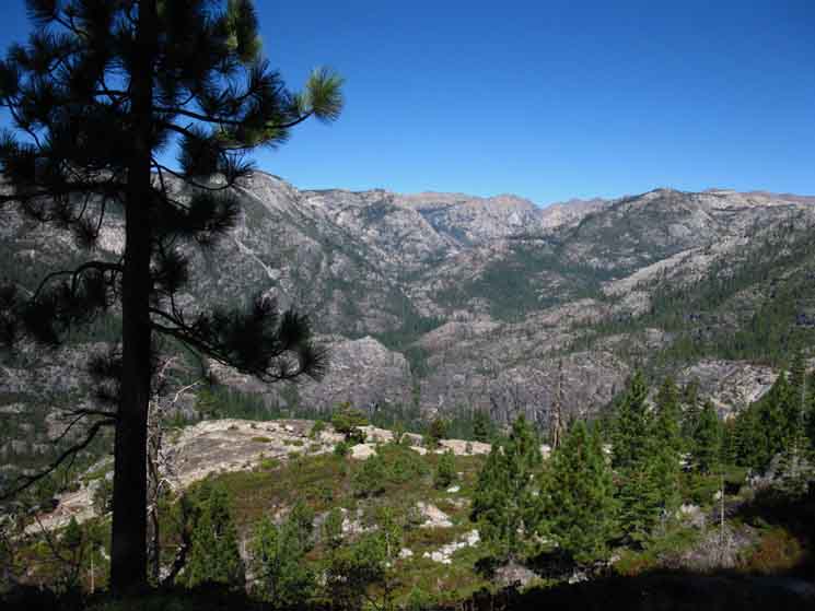 |
Climbing higher reveals expanding majestic views North up Summit City Canyon. Looking North at our position from the End of Summit City Canyon |
North: Camp Irene South: Lake Alpine
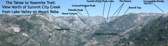
Below: The view up Summit City Creek from the Northern Flank of Mount Reba. Summit City Creek intersects with the North Mokelumne River flowing into the frame from the Right, between the near descending ridge, and the massif beyond blocking our view of Round Top.
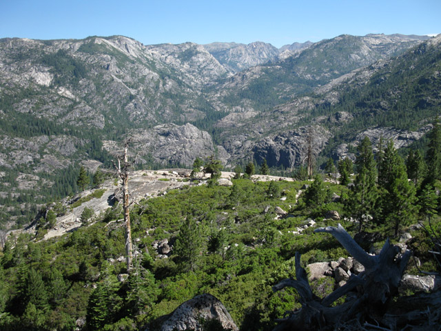
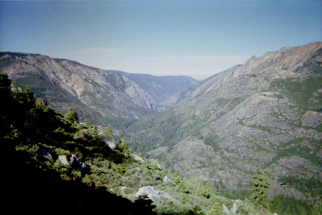
| A Big View of Summit City Creek's Canon, showing where we entered the canyon by rounding the Sisters' Left Shoulder, passing by Fourth of July Lake as we dropped down into the canyon. | ||
 |
||
This image is valuable for Northbound hikers planning a Lake Alpine to Carson Pass trip, as well as Southbound Tahoe to Yosemite hikers heading through this difficult section. Now check out the pointy granite feature below us, and our position here below the mouth of Underwood Canyon from the End of Summit City Canyon.
|
This view of Summit City Creek has good detail. I took this with an old SLR in the '90s
 |
Above we have a series of views of Summit City Canyon over the last 15 years. Looking North at our position from the End of Summit City Canyon |
 |
||
Turning our attention West by Southwest we notice the main feature on the other side of the Canyon of the North Molkelumne River is Mokelumne Peak. We notice the unique feature on its Southeast facing flank, a series of serrated rock features known as the Mokelumne Tetons.
|
 |
v |
 |
||
Climbing around the face at the end of the ridge arm making up the North flank of Lake Valley. We will work our way to the right of this peak to bend Southeast around its flank into Lake Valley.
|
 |
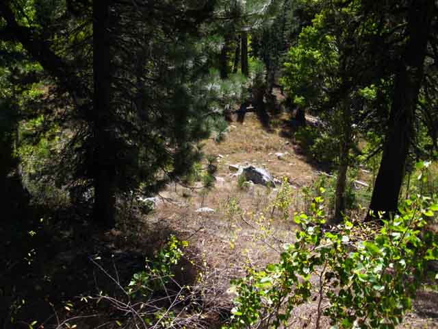
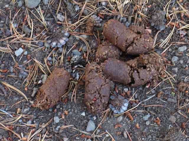
Very old bear crap near the mouth of Lake Valley. |
 |
Through manzanita on final approach to Lake Valley. |
 |
||
Tahoe to Yosemite Trail bending into Lake Valley. We can plainly see up upcoming trail route bending into Lake Valley. The West Mount Reba Peak is visible across the mouth of Lake Valley. Our trailhead is beside the Eastern Mount Reba Peak at the head of Lake Valley. Looking North at our position from the End of Summit City Canyon.
|
A Visitor
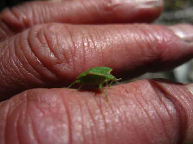 |
A little beetle flew over and landed for a visit. |
 |
We checked each other out and went on our ways. |
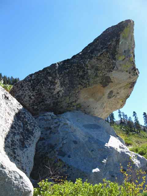
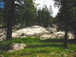
Nice Rock on Pedastal
 |
v |
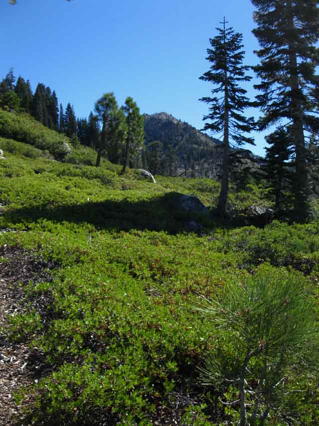
Entering Lake Valley's North End
 |
||
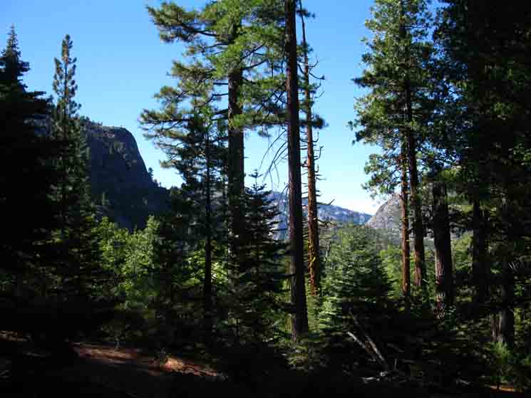
Mount Reba across the mouth of Lake Valley. Looking North at our position from the End of Summit City Canyon.
|
Entering Lake Valley
| These ripples descending from the top of Mount Reba looked small from Summit City Creek! | ||
 |
||
The trail does well following the logic of the terrain through here. |
Meadow in mouth of Lake Valley. |
 |
||
Looking South at the base of Lake Valley we see one of a series of meadows lodged into the terrain.
|
 |
Old sign of bear activity. |
 |
Campsite at the forested entry to Lake Valley
| Entering Lake Valley below the peaks of Mount Reba. | Campsite at the mouth of Lake Valley. | |||
 |
 |
|||
| This is a nice place to take a break from the sustained climb up the Northwest Flank of Mount Reba. | ||||
| We enter a small bit of forest cover as we pass up Lake Valley. |
North: Camp Irene top of page South: Lake Alpine
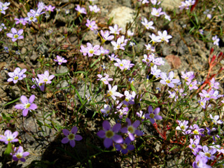
I find Wild Flowers very Relaxing
| Daises greet us in Lake Valley. |
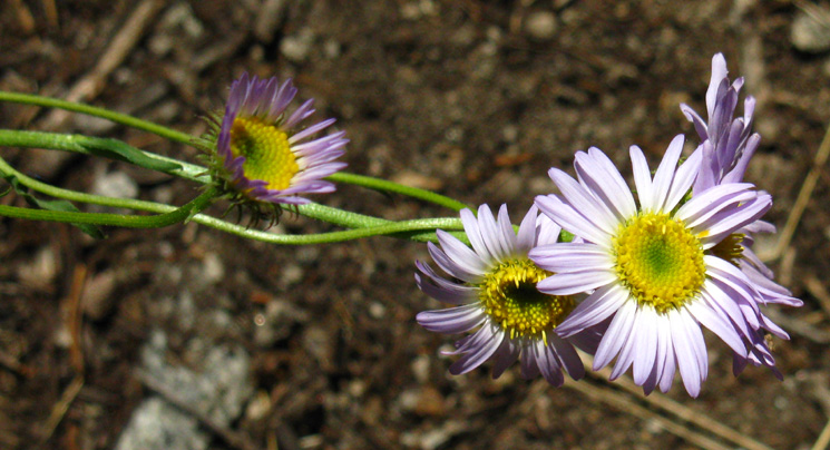 |
Wildflower: Sierra daisy, stalked fleabane, Erigeron algidus |
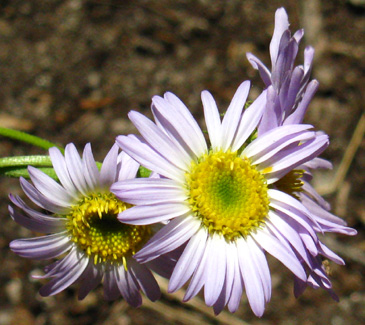
Stop to Smell the Flowers every now and then...
| Subtle colors and patterns | ||||
 |
 |
|||
| Simple beauty is composed of complexity. |
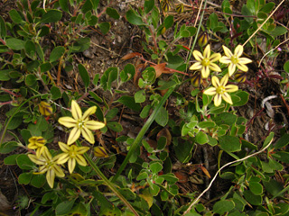
High Sierra Nevada Wildflowers
| Pretty Face, Golden Brodiaea, North Flank of Mount Reba, July 19, 2009 | Unknown Purple | |||||
 |
 |
|||||
| Comments/Flowers | Comments-identify/Flowers |
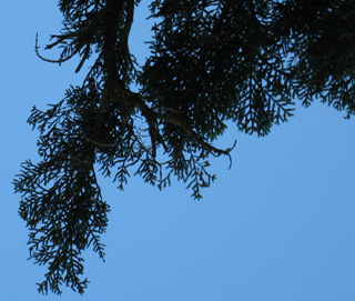
Spruce Grove in Lake Valley
| Spruce | Unique branch and needle pattern of Spruce. | |||
 |
 |
|||
| Comments/Trees | ||||
Spruce and wildflowers in Lake Valley. |
INDEX |
Nice backpacking couple at the campsite entering Lake Valley
| Unlike the human hikers, Dog was not real happy I was there. | INDEX | |||||
 |
This nice couple, and their neurotic dog, were taking a break at the campsite in Underwood Valley on the North side of Mount Reba when I arrived. They were nice enough to share their break spot with me. They had hiked down to Camp Irene and back from Lake Alpine. Note our different approach to clothing. I'm wearing a tank top and shorts, while they prefer long sleeves and long pants. We took different approaches to balancing comfort between the heat of long clothing vs the exposure to mosquitoes of shorts and a tank top. |
|||||
| I just rubbed this guy the wrong way! This is not a "I'm happy to see you" look on Dog's face. | Mosquitoes! |
 |
||
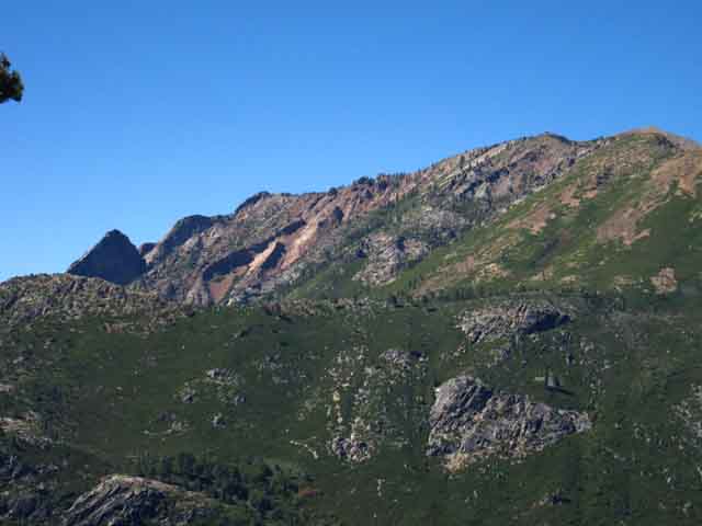
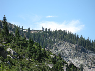
Peak of Mount Reba visible through thin tree cover.
|
 |
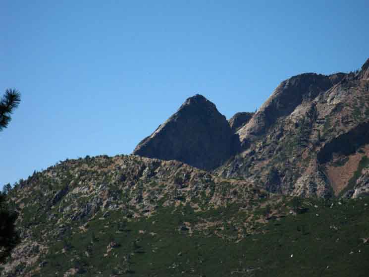
Mokelumne Peak from Lake Valley. |
 |
||
v
|
 |
Great rock block section as we reach the top and end of the granite. |
 |
v |
| Lake Valley features a beautiful, but short, almost-flat area before you resume climbing to the peak of Mount Reba. | ||||
 |
||||
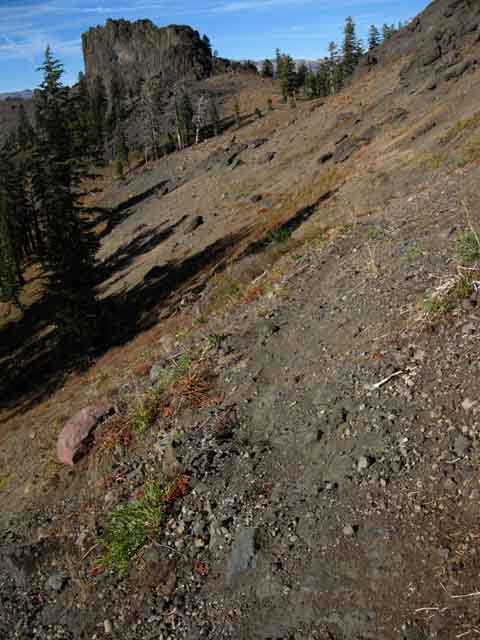
Though still moving through granite terrain in Lake Valley, as we climb above it towards the top of Mount Reba, we will see elements of a vast interface zone between granitic and volcanic terrain, and cross it, into predominantly volcanic terrain. |
||||
| We will constantly cross fingers of lava around islands of granite. |
 |
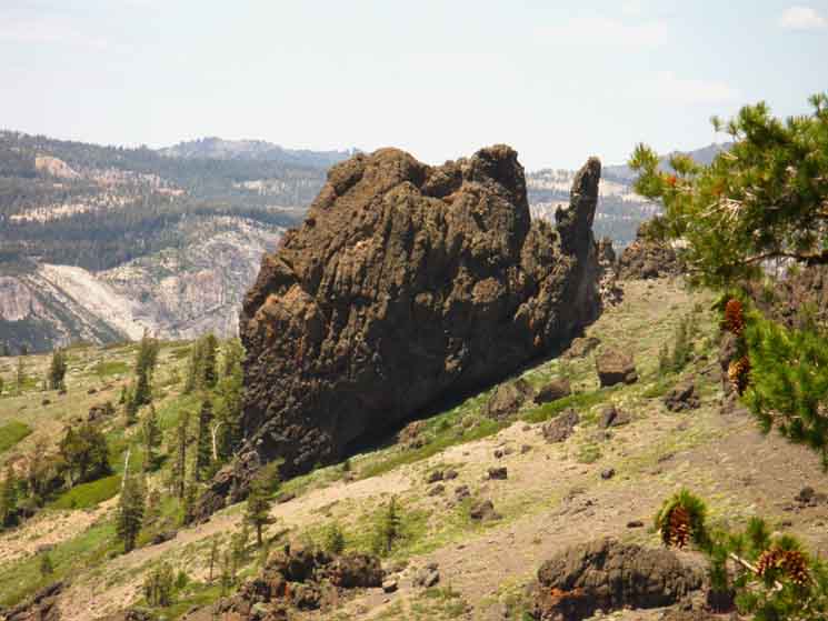
As we approach the top of Mount Reba, we can see that the ridge top separating Lake and Underwood Valleys is decorated with exotic volcanic features. Beautiful pedestal. |
| Looking SW at crest line across the Western side of Lake Valley just North of Mount Reba. | ||
 |
||
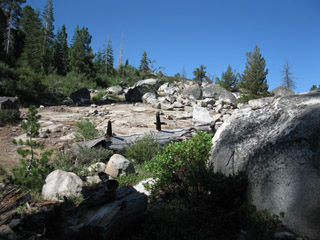
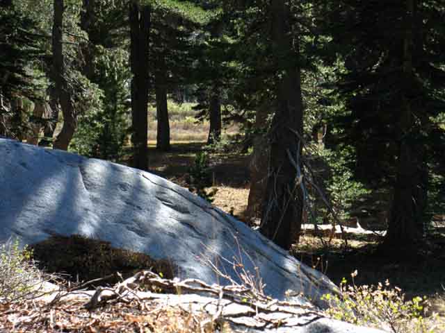
The head of the valley looks very promising for camping.
|
The Final steps South up to the top of Mount Reba
 |
||
Rising above forest and granite into the volcanic terrain topping the ridgeline of Mount Reba.
|
 |
||
v
|
 |
v |
 |
As the trail pushes over to the Southeast side of Lake Valley for the final climb up to the top of Mount Reba the garden of volcanic rock formations decorating the top of the ridgeline comes into view. |
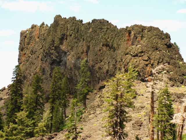
Hard Volcanic Rock Formations along the ridge line dividing Lake Valley from Underwood Valley run up the ridge line to the crest line Reba sits upon.
 |
As we have just hiked around massive granite to get up here, it is a breathless transition. Note the protruding element. |
 |
As we climb high enough to see the ridgecrest and get long views North we are positioning ourselves for the final climb up to the top. The trail swings East before beginning the switchbacks up to the top of Mount Reba. |
Switchbacks just below the Top of Mount Reba.
 |
||
We are now entering volcanic terrain, after leaving the last bits of granite behind us in Lake Valley.
|
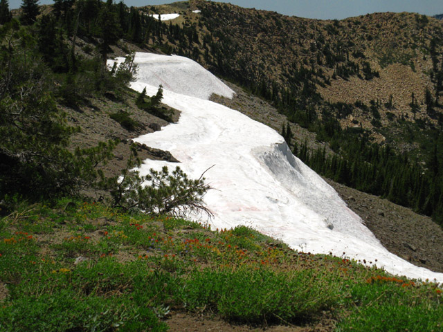
The Snow Berm just below the Northwest approach to the top of Mount Reba
| The snow berm just below the top of Mount Reba. Though shrunken in this image, I have seen this snow berm covering the final couple of hundred yards of the steepest part of the trail below the Northern flank of Mount Reba, in June and early July. | ||
 |
||
North: Camp Irene top of page South: Lake Alpine
Snow Berm Story A long time ago I was doing an early Spring trip between Lake Tahoe and Yosemite. Snow remnants all along the trail, and packing the route across mountain gaps and passes made the trip difficult and exciting. At the time I did not own an ice axe or crampons. I reached the steep wall of hard Spring snow covering the last couple of hundred yards up to the top of Mount Reba, exactly the same one pictured above, except for its size. This early Spring berm bearded the whole ridgeline along the Northern side of the ridge crest, and extended about 200 yards down the Northern flank of Mount Reba, to where it terminated in mushy, wet soil. My only option was to kick footsteps into the hard surface of the berm, to create my own steps up the snow berm to the top of Mount Reba. I was doing fine, until I was about 20 yards below the top of the snow berm. I figured out later that I was pretty tired, and likely I became lazy while kicking steps, not making the last few deep enough into the snow berm. Just below the top of the berm my last footstep broke out, and I whacked the flank of the berm, and bounced onto my side, as I started a rapid slide down the steep snow berm. I was picking up speed sufficient to possibly injure myself significantly as I slid down the steep berm, and again at the bottom. Being on my side, I flipped onto my ass into the seated position, and reached up and back to grab the top uprights of my external pack frame. Self Arrest with an external framed pack Grabbing and pulling the pack frame uprights at the top of my pack towards my shoulders causes the bottoms of the uprights to pull away from the top of my ass, and dig deeply into the snows of the flank of this steep snow berm. I came to a very rapid stop. I was pretty happy with my crafty self-arrest, until the receding numbness of my frozen ass brought me to the realization that my ass REALLY hurt. Closer inspection showed that the butt of my pants was gone, worn away my rapid trip down the hard ice of the berm. Darn. My brief slide down the hard, steep, icy surface had removed the butt of my pants, and threw in a free sandpapering of my ass. I was stepping gingerly for a few days after that slide... and the kids at the Lake Alpine store were laughing like heck when I came in to buy a set of shorts to replace my trashed nylon pants. Darn! |
 |
||
v
|
 |
Last steps up to Mount Reba Trailhead. |
The top of Mount Reba
 |
||
v
|
At the Wilderness Boundary at the top of Mount Reba. Over my shoulder you can see the trail dropping off the North side of Mount Reba. |
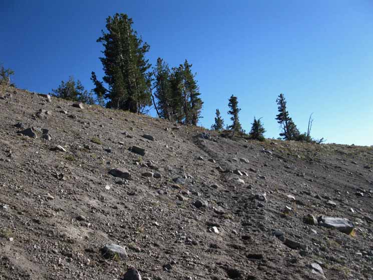
Mileage sign at the Top of Mount Reba. | |||
 |
 |
|||
This sign indicates that the distance between Highway four and Camp Irene is Nine Miles. The Sign at Camp Irene posted this distance at 8.8 miles. My experiences and measurements indicates that the distance between Camp Irene and the Bee Gulch trail head on Highway 4 is 8.02 miles. |
||||
We entered the Stanislaus National Forest Southbound passing through Camp Irene and are now exiting the Mokelumne Wilderness at the top of Mount Reba. |
||||
The North High Sierra from the Top of Mount Reba
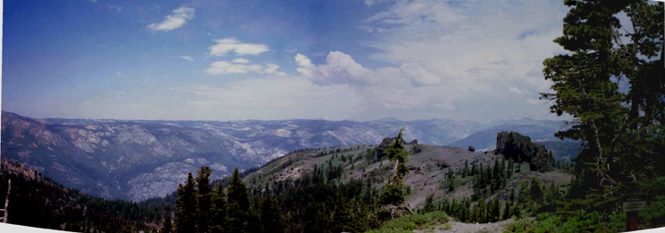
| Crossing over to the South flank of Mount Reba. |
Road Map
|
View Highway 4: Ebbetts Pass, Lake Alpine, and Bear Valley Road Map in a larger map |
I add this road map as our trailhead at the top of Mount Reba is a couple of hundred yards from an active dirt road. This dirt road runs down to the road from Highway 4 to the Bear Valley Ski Area. Though an old jeep track runs right up to the trailhead at the top of Mount Reba, the last couple of hundred yards of the jeep track are now off limits to vehicles. But you can drive to within a couple of hundred yards of the trailhead at the top of Mount Reba, so I have added the map above. See all Tahoe to Whitney Road Maps. |
North: Camp Irene top of page South: Lake Alpine
Dl E back |
The Echo Summit trail H THIS PAGE IS Still UNDER CONSTRUCTION: STAY TUNED FOR A BIT MORE! COME ON BACK NOW, 'YA HEAR?
7.5 Topo Hiking Map: Summit City Creek to Mount Reba Big 7.5 Topo Hiking Map: Summit City Creek to Mount Reba 30 min Regional Topo Hiking Map: Echo Summit to Lake Alpine South: Bee Gulch to Lake Alpine |
Backpacking Trail Guide North |
 |
Backpacking Trail Guide South |
Backpacker ForumsHave General Information or Questions about Long-Distance Backpacking, Gear, or the Sierras?Post it on: TahoetoWhitney.OrgYour comments and questions posted from this page appear on the Mount Reba Forum Page.Register to post your own stand-alone pages about your trips and the trails around Round Top Lake on the Carson Gap to Lake Alpine Forum.Section: Carson Gap to Lake AlpineLocation: Up the North side of Mount Reba |
North: Camp Irene South: Lake Alpine
Home Page
Contact Alex Wierbinski

Backpacking Lake Tahoe to Mount Whitney
Your guide to the High Sierra Crest, including the Tahoe to Yosemite, Pacific Crest, and John Muir Trails
